
← AGP Consulting
Technologies
AGP-TEM
Multipurpose airborne time-domain electromagnetic survey system
X, Y, ZMeasured components
Up to 500 mInvestigation depth, conditions dependent
25 / 75 HzBase frequency
AGP-TEM
System overview
AGP-TEM is an airborne geophysical survey system based on pulsed inductive electromagnetics, implementing the time-domain electromagnetic (TEM) method. AGP-TEM supports mineral exploration, engineering geology and hydrogeology through detailed investigation of subsurface electrical conductivity and resistivity.
The standard AGP-TEM configuration includes magnetometry and can be expanded with gravity surveying, gamma-ray spectrometry, airborne laser scanning and aerial photography.
System characteristics
- Compatible with most helicopters
- Approx. 5 m along-line measurement spacing
- Advanced post-processing to suppress noise from multiple sources
- 1D and 3D data inversion
- Accounting for inductively induced polarization
Core capabilities
- High lateral and vertical resolution
- Depth of investigation up to 500 m, depending on geology and survey conditions
- Key parameters configurable for specific geological objectives and survey conditions
Exploration applications
Copper-nickel sulphide deposits
Gold deposits
Massive sulphide deposits
Uranium deposits
Lead-zinc deposits
Kimberlite pipes
Primary exploration tasks
- Detailed exploration for conductive targets
- Detailed delineation of alteration zones
- Delineation of fractured and brecciated zones
- Mapping palaeochannels and palaeovalleys
- Delineation of karst features
- Mapping weathering profiles
- Mapping permafrost distribution
- Aquifer exploration
- Delineating heterogeneity in the near-surface low-velocity layer to support geological and geophysical models used to refine seismic static corrections
- Investigating ore-controlling zones and tracing ore-localizing faults laterally and at depth
Equipment
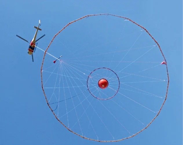
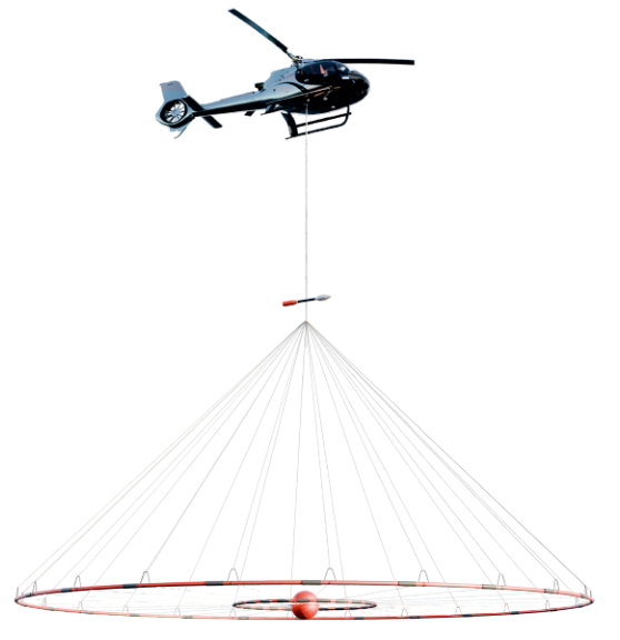
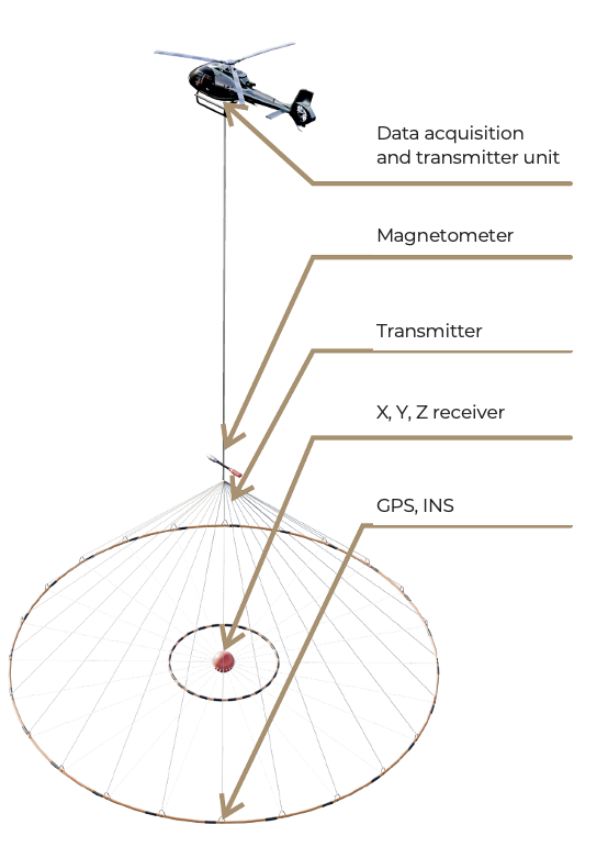
System components
- Data acquisition and transmitter unit
- Magnetometer
- Transmitter
- X, Y, Z receiver
- GPS, INS
Technical reference
AGP-TEM specifications
| Measured components | X, Y, Z |
|---|---|
| Base frequency | 25 / 75 Hz |
| Transmitter loop diameter | Up to 18 m |
| Pulse shape | Trapezoidal |
| Pulse duration | Up to 10 ms |
| Raw-data sampling rate | 250 kHz |
| Number of time gates | Configurable |
| System noise level | 0.2 nT/s |
| Transmitter dipole moment | Up to 400,000 A·m² |
| Survey speed | Up to 170 km/h |
| Receiver position | At the centre of the transmitter loop |
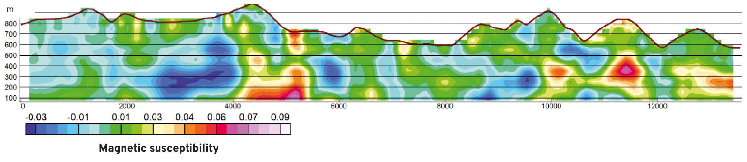
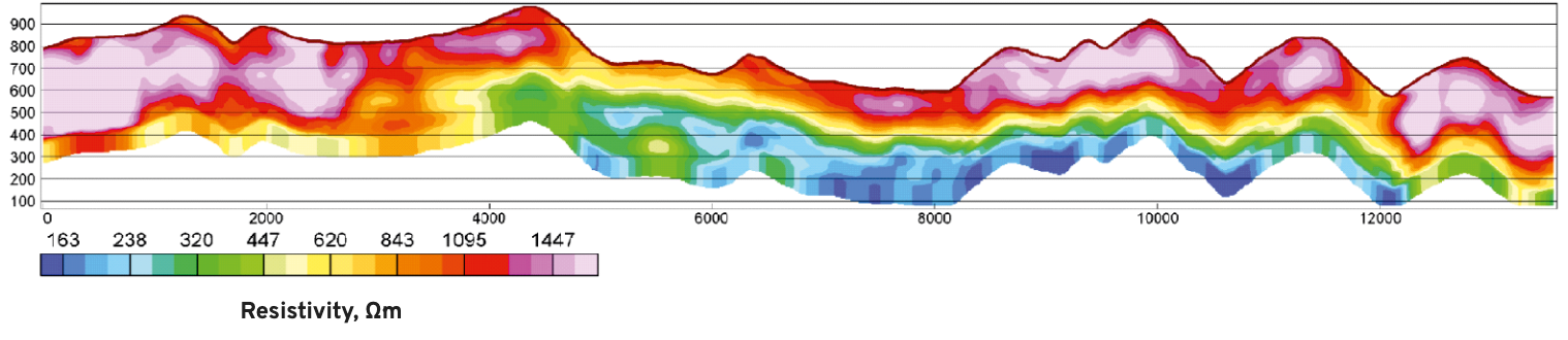
Survey examples
Advantages over ground-based methods
- Shorter field acquisition campaigns
- Surveying in mountainous and difficult-to-access terrain
- Consistent acquisition parameters
- Regular survey grids with fewer coverage gaps
- Extended field season, subject to weather and operating conditions