
Airborne geophysics / Uncrewed systems
AGP-UAV MULTI
Geophysical survey systems
for uncrewed aircraft systems.
Geophysical surveying
EM surveying.
Magnetometry.
Gamma-ray spectrometry.
Investigating subsurface electrical properties. Investigating the magnetic properties of rocks. Mapping the distribution of naturally occurring radionuclides.
Airborne laser scanning: terrain analysis using high-accuracy terrain models. High-resolution photo and video surveying.
Survey methods
Geophysical survey systems
SAEM / EM surveying
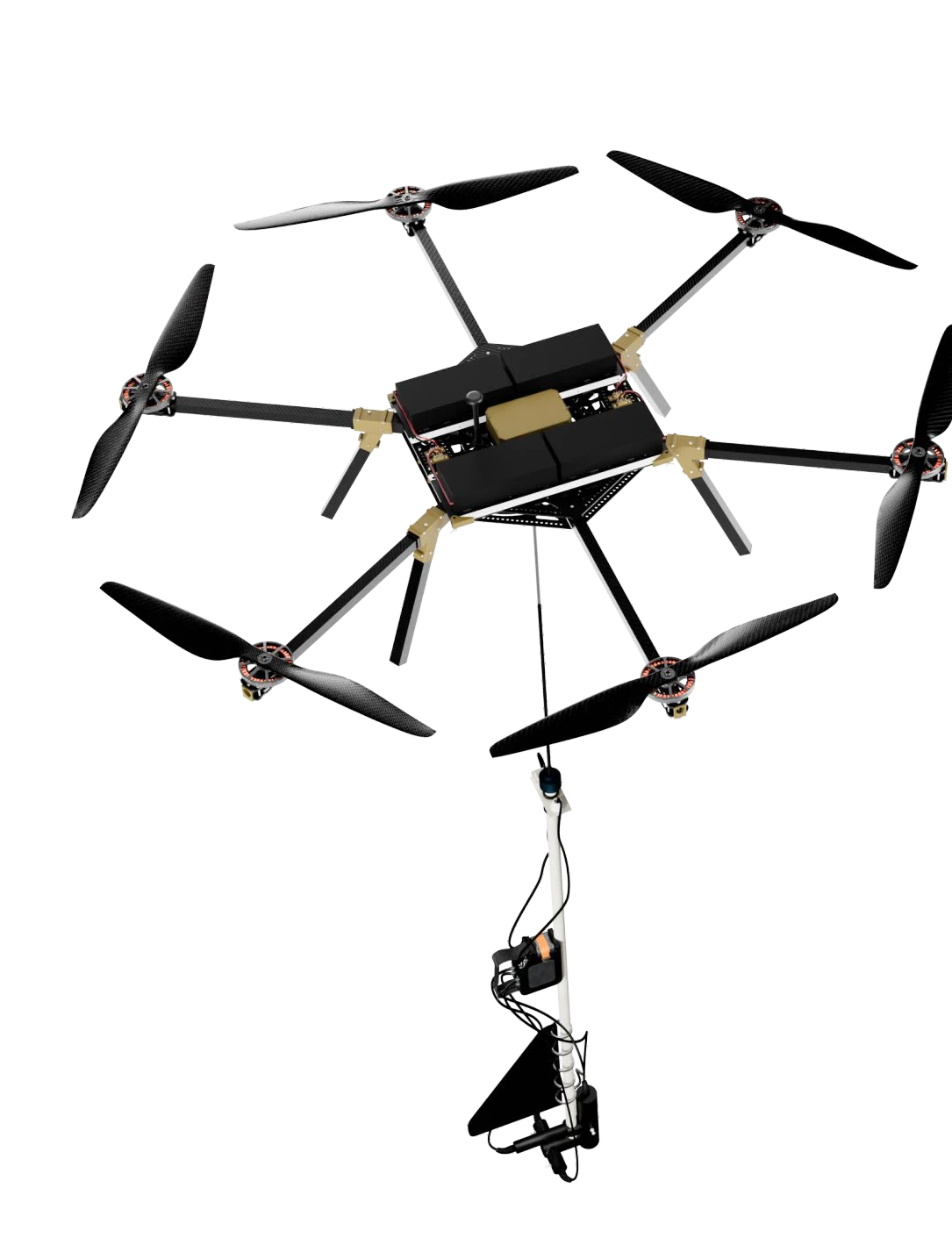
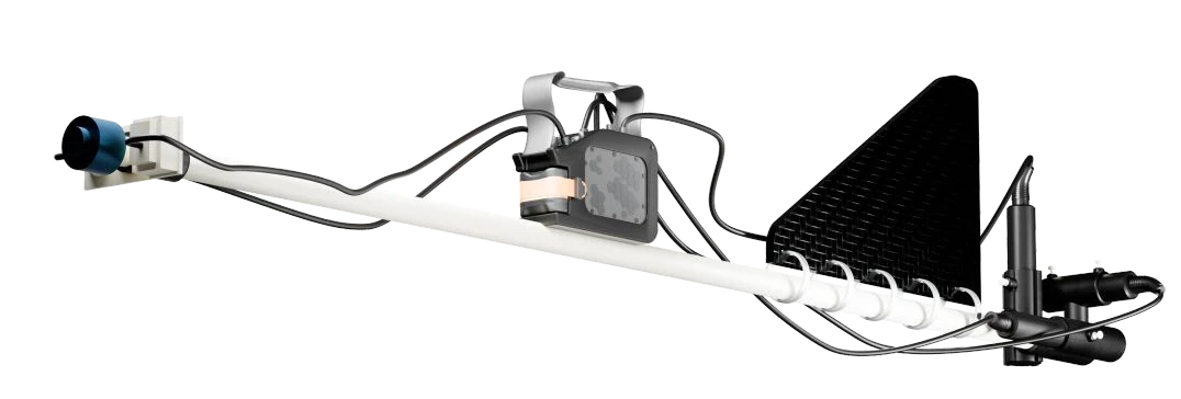
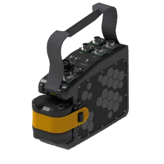
Investigating subsurface electrical properties
- Identify aquifers
- Map folds and related structures
- Map geological units and delineate weathering profiles
Applications & system configuration
- Investigate the internal structure of intrusive bodies
- Map linear fracture zones, including permeable and sealed zones
- Map faults of different scales and kinematic types
- Identify mineralization associated with conductive minerals
- Map basins filled with poorly lithified sediments
- UAV-suspended platform with sensors, digital recorder, GNSS and INS
- Ground transmitter current measurement using a current clamp, recorder and GNSS
- Compatible ground transmitter; suitable Zonge and Phoenix transmitters are examples
- Optional transmitter and spare parts
- Processing and inversion software
Technical specifications
| Stated investigation depth | 1–1,500 m, depending on conditions |
|---|---|
| Frequency range | 10 Hz–100 kHz |
| Survey spacing | 10–50 m |
| Sensor platform weight | 4 kg |
| Magnetic components | 3 |
| Transmitter–receiver offset | From hundreds of metres up to 5–7 km |
GTS-1 transmitter
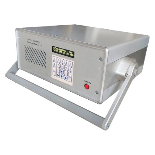
GTS-1 transmitter
Programmed laptop operation enables automated multi-frequency sounding. An intelligent algorithm detects the transmitted frequency intervals for single-transmitter measurements.
| Frequency range | 0.1 Hz–1,000 kHz; rectangular signal |
|---|---|
| Maximum transmitter power | Up to 1 kW |
| Sounding cycle | 5–30 seconds across 3–4 frequency decades |
| Load outputs | Two switchable outputs |
MAG / Magnetometry
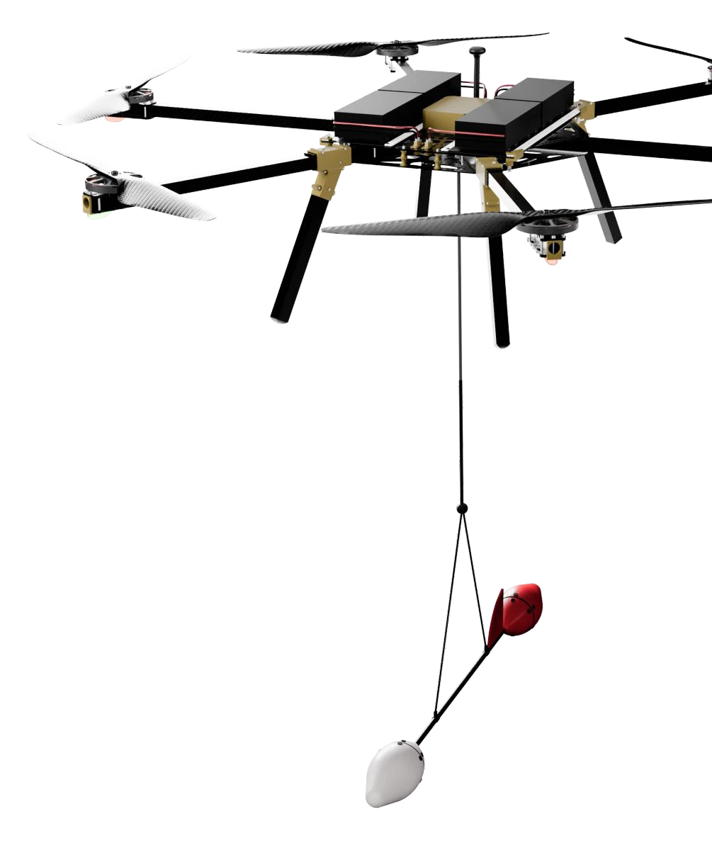

Investigating the magnetic properties of rocks
- Map geological units with contrasting magnetization
- Locate magnetized bodies and estimate their burial depths
- Investigate intrusive bodies and their internal and external contact zones
Applications & system configuration
- Map mineralized fracture and breccia zones
- Map faults of different scales and kinematic types
- Operate independently or together with a gamma-ray spectrometer
- Low payload weight supports flight endurance
- High sampling rate supports filtering of anthropogenic and natural noise
- Closely spaced magnetic profiling
- Built-in autonomous GNSS receiver for spatial referencing
Technical specifications
| Sensing element | Rubidium Mz sensor |
|---|---|
| Sampling rate | Up to 400 samples/s |
| Sensitivity | 1 pT/√Hz |
| Measurement range | 1,000–100,000 nT |
| Equatorial dead zone | ±7° |
| Orientation error | Low |
| Weight including battery | 2 kg |
| Operating temperature | −25 °C to +60 °C |
GAMMA / Gamma-ray spectrometry
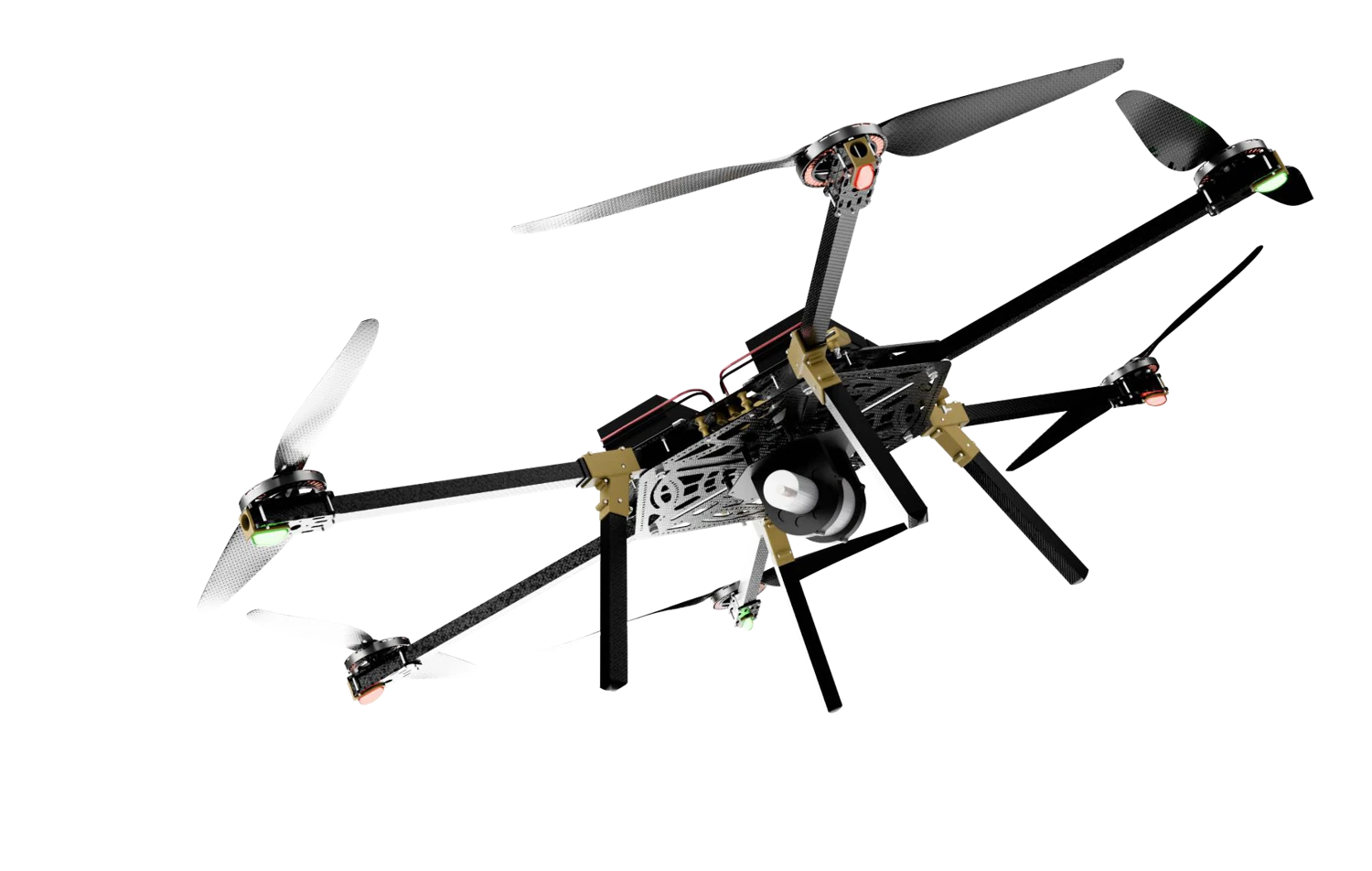
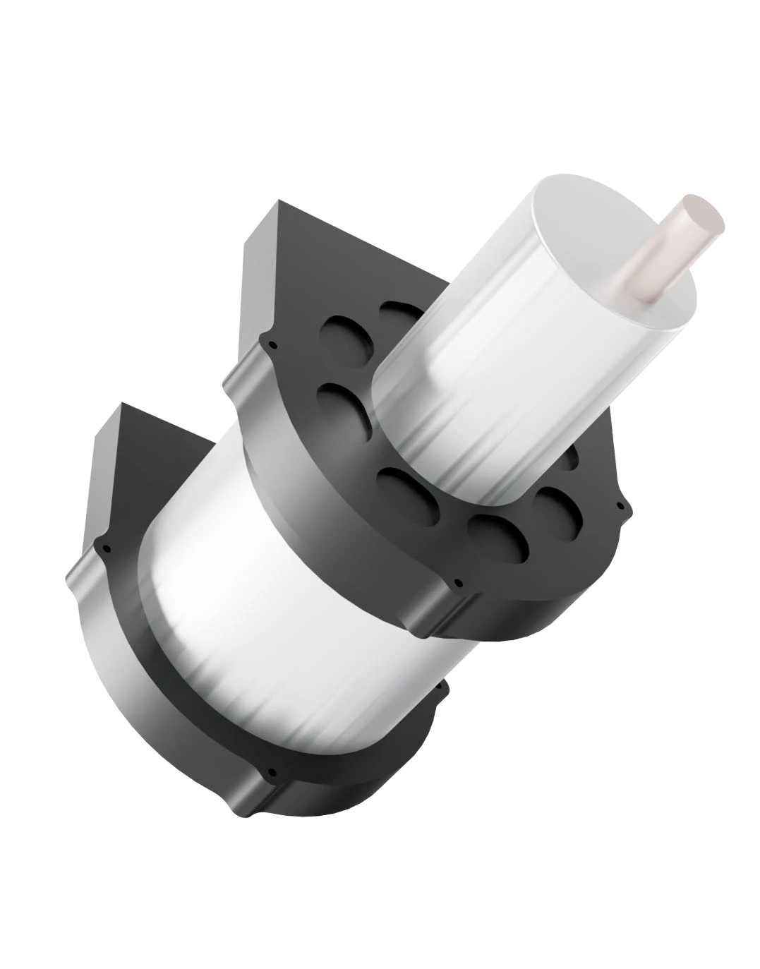
Mapping the distribution of naturally occurring radionuclides
- Map geological units with contrasting radioactivity
- Distinguish igneous units by their radiogeochemical signatures
- Delineate superimposed hydrothermal and metasomatic alteration
Applications & system configuration
- Identify indirect indicators of potentially buried granitoid intrusions
- Detector crystal protected against moisture and mechanical damage
- Environmental monitoring, radiation-source detection and radioactive-ore exploration
- Interpretation of ore-controlling structures and placer deposits
Technical specifications
| Scintillation crystal | NaI(Tl) |
|---|---|
| Crystal volume | 0.4 L / 1 L |
| Energy resolution at Cs-137 | 7.2% |
| Channels for 0.4 L / 1 L | 1,024 / 4,096 |
| Detector type | Scintillation |
| Energy range | 50–3,000 keV |
| Recording | Full spectrum |
| Power supply | 12 V |
| Power consumption | No more than 6 W |
| Operating temperature | −25 °C to +50 °C |
| Protection rating | IP64 |
| Mass | 4 kg |
Airborne laser scanning
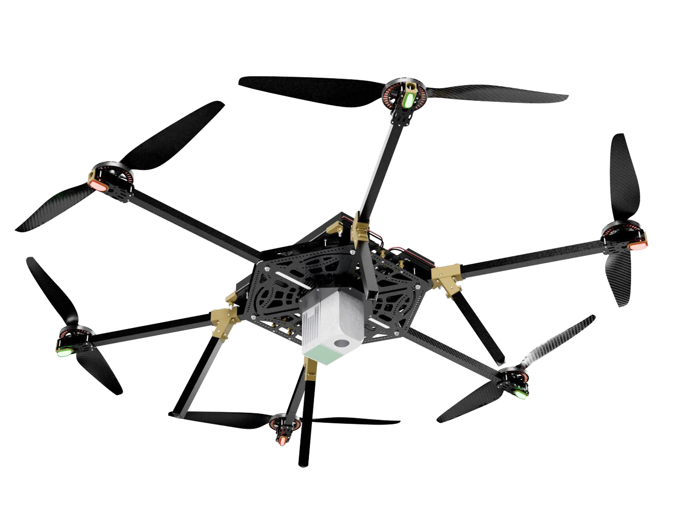
Terrain analysis using high-accuracy terrain models
- Plan ground geophysical and geochemical survey traverses
- Support seismic and gravity surveys
- Provide accurate topographic basemaps for active exploration licences
Applications & system configuration
- Produce topographic plans for mine development
- Support access-road and utility design and construction
- Monitor extraction volumes
- Operate as part of the geophysical suite or independently
- Combine terrain data with magnetics, radiometrics and EM results
Technical specifications
| Absolute RMSE | 2–5 cm horizontally and vertically |
|---|---|
| Range precision | 15 mm (1σ at 150 m) |
| Maximum scan rate | 500,000 measurements/s |
| Range | 450 m |
| Field of view | 70.4° |
| Returns | Up to 3 |
Aerial imaging
High-resolution photo and video surveying
| Nominal resolution | 48 MP stated; approximately 44.7 MP from image dimensions |
|---|---|
| Image dimensions | 8,184 × 5,460 pixels |
| Pixel pitch | 4.4 µm |
| Minimum capture interval | 1 s |
- Detailed imagery alongside the geophysical and terrain survey outputs
- High-resolution photo and video survey options
The flight platform
STR6 drone platform.
AGP-UAV MULTI is a modular geophysical surveying complex built on the unified STR6 drone platform. Select electromagnetic, gamma-ray, magnetic, airborne laser scanning and aerial imaging modules around the geological objective.
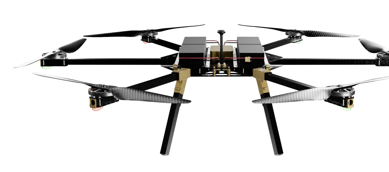
- Thrust-to-weight balance designed for flight range
- Field-maintainable main assemblies and rapid deployment
- On-board LiDAR for real-time terrain-following altitude tracking
- Telemetry for flight data and remote control at ranges up to 20 km
- Power consumption monitoring to assess motor load
- Navigation module with simultaneous reception from four signals and enhanced interference protection
Survey capabilities
- Investigate electrical and magnetic properties of rocks
- Map the distribution of naturally occurring radionuclides
- Analyse terrain using high-accuracy models
- Produce aerial imagery to support survey interpretation
- Automatic and manual operating modes
- Telemetry and control at ranges up to 20 km
- Payload-dependent flight duration up to 60 minutes
- Modular instruments for different survey objectives
STR6 / Technical reference
| Flight duration with payload | Up to 60 minutes, depending on payload and conditions |
|---|---|
| Maximum flight speed | 14 m/s |
| Terrain-following speed | 4–10 m/s |
| Rate of climb | 4 m/s |
| Maximum allowable wind speed | Up to 12 m/s |
| Maximum take-off weight | 29 kg |
| Weight without payload | 18 kg |
| Maximum flight altitude | 4,000 m above sea level |
| Operating temperature | −25 °C to +40 °C |
Flight duration depends on payload, weather and mission profile.
Ground control
Advanced ground control station
A proprietary 10-inch rugged tablet combines real-time data transmission, telemetry and UAV control. Waterproof and shock-resistant construction supports demanding field operations; detachable high-sensitivity joysticks allow standalone tablet use.
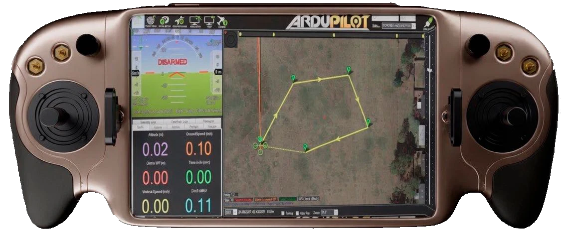
| Display | 10-inch rugged tablet |
|---|---|
| Operating systems | Android, Windows or Linux, selectable |
| Control and telemetry range | Up to 20 km |
| Built-in battery endurance | Up to 24 hours |
Field operation
- Use the tablet independently for field processing, navigation and analysis
- Continuous field operation with a built-in battery
- Detachable control joysticks for flexible deployment
Applications
Applications
Exploration tasks
- Map contrasting electrical, magnetic and radiogeochemical properties
- Investigate structures, intrusive bodies and mineralized zones
- Combine subsurface interpretation with detailed terrain data
- Support exploration planning and engineering with topographic basemaps
Survey output
Completed projects
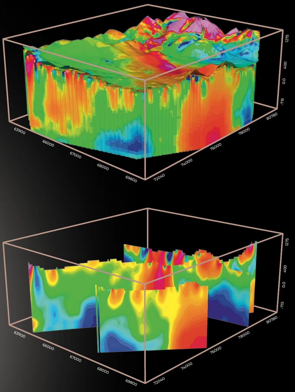
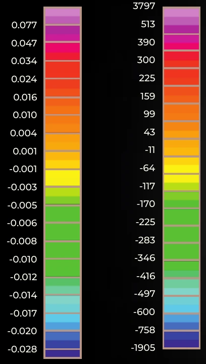
Completed-project example: three-dimensional subsurface interpretation. Select an image to inspect the model or colour scales at full size.
AGP Consulting